
Trace a Woodburn Street Directory
For a named Woodburn street, begin with one complete street address rather than a broad person-name search. The Marion County Assessor lets a user choose Situs Address, the physical location of a parcel, then enter the address as the search criterion. When the wording does not return a match, City GIS can help check the current address spelling and locate the tax lot. The resulting property record separates the situs from the owner mailing address. That distinction matters because an owner may receive tax correspondence elsewhere.
- Search the complete address with the Assessor’s Situs Address category, or carry a map-tax-lot or account number from the map.
- Record the property ID, tax lot, legal description, and current recorded owner separately from the property location.
- Use the City map to place that tax lot with streets, city limits, the urban growth boundary, zoning, and other map context.
- Search the current recorded-documents route with the owner name, recording date, and legal-description fields to find an acquisition instrument.
- Follow the seller as an earlier grantee, then use dated directory or street-guide evidence only for the period it actually represents.
That order creates a documented address trail: address, assessor record, tax lot, legal description, owner, then deed parties. It does not create a list of everyone at a street address. For a question about one named person instead of a property trail, the Woodburn resident lookup uses a different, person-centered path.
Woodburn Address Record Keys
Woodburn address records use several keys, and each must stay in its own lane. The Assessor’s property card can show an owner name and owner address, a situs address, map tax lot, property ID, legal description, subdivision, neighborhood, and value or exemption fields. A tax correspondence address may be a post-office box, a care-of address, or another location. It should never be treated as proof of a household at the Woodburn situs. Likewise, a value or exemption entry is property-tax context, not a residents list.
- Parcel
- A recorded piece of land represented in the property system by such keys as a tax lot or property ID.
- Situs address
- The physical location of the property, used by the Assessor as an address-search key.
- Plat
- A recorded subdivision or map reference that can connect a street address to lot and block information.
- Criss-cross directory
- An address-to-name directory format, useful only for the specific volume and year that has been checked.
A legal description, plat, lot, block, or map-tax-lot often survives an address-format change better than a street number alone. That legal key is what connects the Assessor record to the Clerk’s title records. It also helps avoid a false match when similarly named streets, directional prefixes, or an older place name appear in different sources.
Woodburn Assessor Street Search
The Marion County Assessor property search is a proper starting point for a Woodburn street directory inquiry because it is built around property identifiers. It is not an owner-name search and it does not provide a browse-the-entire-street mode. The form is refreshed on a daily cycle, while the county cautions that original records control and tax-roll certification can affect updates in the annual certification period. If the web result is unclear, the county says staff can provide an owner name and mailing address from an address or location by phone at 503-588-5144.
| Assessor field | Type | Needed | Woodburn use |
|---|---|---|---|
| Search Category | Dropdown | Yes | Choose Account Number, Map Tax Lot, Situs Address, or Subdivision. |
| Search Criteria | Text | Yes in practice | Enter up to 50 characters in the format required by the selected category. |
| Search | Button | Yes | Runs the selected property query. |
| Find Property on Map | Link/control | No | Moves from a mapped location toward a property record. |
| Property Summary | Result navigation | After a match | Opens the record with tax, assessment, and improvement paths. |
Use the result as a record locator. Save the site address, tax lot, property ID, and legal description before leaving the result. Those details are more reliable inputs for the next office than a guessed street-wide list.
The Assessor panel may show tax and assessment information, but a tax record does not replace an original deed, survey, or permit file. Ask the appropriate custodian for the controlling document when the exact wording or certified copy matters.
Woodburn GIS Street Layers
The City’s map service adds the geographic context a parcel card cannot show. Its published layers include Current_Addresses, street labels and streets, tax lots, City Limits, the Urban Growth Boundary, zoning, wetlands and flood-related layers, railroad, and right-of-way information. The service reports Find, Query, Identify, and Export Map capabilities. An address may be close to a city service area or within the UGB without being inside the incorporated city limit, so those layers should be read separately.
The Woodburn GIS map service displays the layer structure that supports this address-to-tax-lot check.
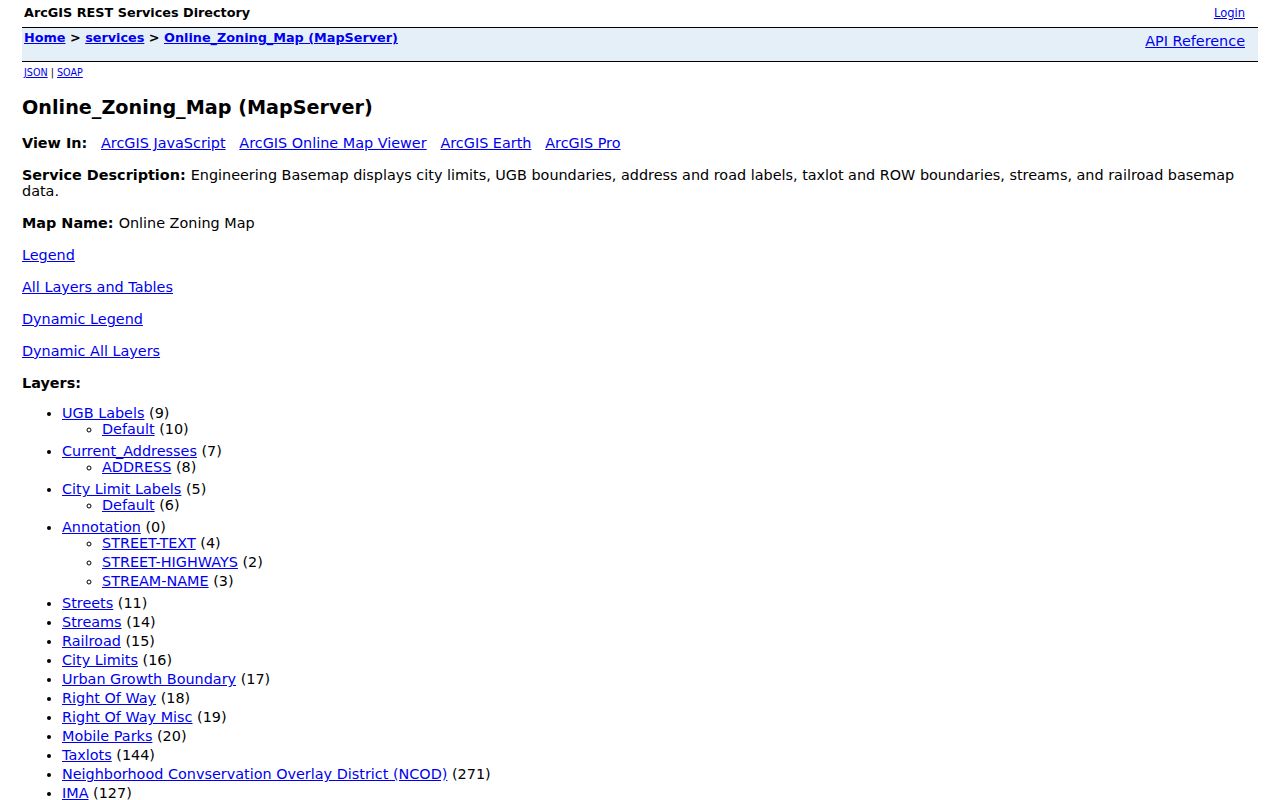
Map graphics are representations, not recorded surveys or precision-navigation documents. Use the city layer to identify an address and tax lot, then verify title and land-description questions with the Assessor, Surveyor, or Clerk record that controls the issue.
Street wording matters here. The City’s development-ordinance research distinguishes directional versions of numbered streets and describes current naming conventions for streets, avenues, roads, highways, and drives. Keep any north or south direction and ordinal wording when testing a permit or map search rather than silently shortening the address.
Woodburn Street Record Coverage
Several offices can contribute a different address-keyed record. The table does not promise that every address has every record. It shows which Woodburn and Marion County channels fit a street question, plus the limit that prevents the result from becoming a household directory.
| Address record | Custodian | What it can establish | Access path |
|---|---|---|---|
| Parcel card | Marion County Assessor | Situs, tax lot, current recorded owner, mailing field, and legal description | Address, account, tax-lot, or subdivision search; phone fallback |
| City map layers | Woodburn GIS | Current address, tax lot, streets, city/UGB, zoning, and map context | Public map service with identify and query capabilities |
| Current documents | Marion County Clerk | Recording date, parties, document type, and legal-description trail | Digital Research Room for 1974-present, then Clerk counter |
| Historic deeds | Marion County Clerk | Direct and indirect parties, dates, and instrument categories | Historic Deeds Search and Clerk fallback for older or unclear links |
| Permit or planning file | Woodburn Building or Community Development | Address-specific work, project, or action history | Custodian or focused public-record route; use ePermitting where applicable |
| Street guide or phone book | WHC or Library collections | Year-specific address listing or business clue | Inspect the actual volume and page; coverage varies |
For older addresses, the source date is part of the evidence. A directory line, aerial image, or street guide can be useful alongside a deed, but none should be stretched into a claim of continuous occupancy.
Woodburn Deed Chain by Street
The Marion County Digital Research Room is the current recorded-documents route identified by the county for 1974 to the present. Its advanced fields can narrow by party type, year, recording-date range, document type, subdivision, lot, block, township, range, section, and legal description. Searching a broad city term is not a street method: a Woodburn party-name search returned thousands of results. Start with the acquisition owner and the legal key from the parcel record, then use a deed-focused document type and a realistic date window.
In a title trail, the person transferring an interest is the direct party, or grantor, and the receiving party is the indirect party, or grantee. Record the instrument number, recording date, seller, buyer, and legal description from the acquisition record. Search the seller as a grantee in the earlier transaction, then repeat while the description and property relationship still match. This ties the deed parties to the correct land instead of treating a shared surname as enough.
The historic route is the Marion County Deeds Search. It accepts date range, instrument type, direct party, and indirect party fields, not a street address or tax lot. The Clerk also makes documents available to search or view at the office without charge; copies can be obtained over the counter or by mail. That counter route is the sensible next step when an image, legal description, or older link will not resolve online.
Woodburn Deed-Date Overlap
One local quirk deserves a deliberate double check. The County Records and Archives page labels historic deeds as 1855 through 1976 and current recorded documents as 1974 to the present. The historic deed interface itself says documents exist for 1850 through 1976. Keep both published descriptions in the research notes rather than choosing an unsupported start year. For a transaction from 1974, 1975, or 1976, search both systems because recordation order, indexing timing, scans, and title variations can put a useful entry in only one route.
This is a comparison of access systems, not a contradiction that can be solved from a street name. The Clerk can clarify the earliest searchable material and retrieve a record when a document number, party, approximate date, book and page, or legal description is available. The historic search screen below is the county’s acceptance-gated entry to that older route.
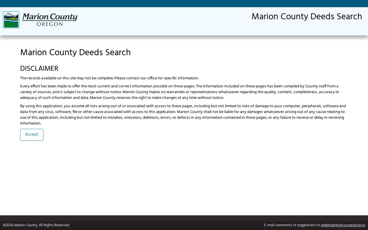
Do not use the date overlap to infer a transfer that the records do not show. It simply tells a Woodburn street researcher to check both official indexes before deciding that a link is missing.
Woodburn Permit Address Evidence
Building and address-assignment files can anchor the timing of work or a newly created postal address. Woodburn Building Division says processed permit status and history may be searched without an account through Oregon ePermitting. Search either a Permit/Application number or Street Number plus Street Name, not both at once. For records more than five years old, clear the Start Date; select the returned address and issuing jurisdiction before treating a result as Woodburn evidence. A permit may list a work-site address, parcel or owner information, and inspection history, but it is evidence of authorized work and status, not a current-resident record.
For a city-held file with no verified public address result screen, give the property and a time range in a focused request to the City Building or Community Development custodian. The Address Assignment Request form can be relevant when the question is when an address was requested or altered. It is expressly not a land-use decision, and a requester’s name does not establish who later lived at the site.
Note: Retain the issuing jurisdiction and permit number because an address match alone may point to county, city, or state records.
Halsey in Woodburn Street Records
Historic address work has a place-name trap. City history says the early town was known as Halsey, was platted in 1872, and incorporated as Woodburn in 1889. An older directory, map, or deed reference may be filed under Halsey, French Prairie, rural Marion County, or another period description rather than the modern city name. Preserve the source spelling and date first. Then compare period maps, such as the City’s 1878 atlas excerpts and 1961 aerials, or the Library of Congress Sanborn editions, before applying a current street interpretation.
The local visual sequence makes a useful comparison: atlas material supplies earlier rural or town geography, Sanborn editions show detailed built context across several dates, the aerials record a later snapshot, and tax lots provide modern parcel context. None of these map sources names every occupant. They help test whether the place, street, or structure is being compared across the right era.
Limits of Woodburn Street Records
Public property records identify a recorded owner, not all people associated with an address. Owner mailing information can differ from the situs. The reviewed sources do not supply an official public list of every household member, utility customer, delivery recipient, or DMV address on a Woodburn street. My Vote also does not provide a by-street browse. Lawful elector-list access has protected-address exceptions, and ballot choices are not part of a street search.
Lawful use. Use Woodburn address and property records for legitimate personal, historical, property, or civic research. Do not use a record trail to stalk, harass, intimidate, or harm anyone, and respect protected voter and address-confidentiality records.
Where a record is protected, redacted, or unavailable, do not fill the gap with assumptions. Ask the custodian about the record type and period, or use a consensual source for contact with a living person.